Case No. #1039
Cailuma Puna, Labyrinthine Vegetation Circle
Summary
In the Cailuma Puna highlands of southwestern Bolivia, an anomalous circular vegetation pattern, distinct from the surrounding environment, has periodically appeared over several decades. Those who enter this area experience a loss of spatial orientation, GPS device malfunction, and a significant distortion of time perception. Authorities consider this phenomenon an unexplained spatial anomaly that cannot be attributed to simple geological or biological factors. Intensive investigation continues into this unique case, where vegetational changes and spatial distortion are intimately linked.
Details
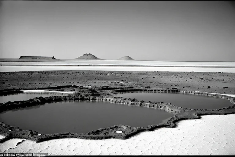
On October 17, 2003, a Bolivian military reconnaissance helicopter flying over the Cailuma Puna highlands discovered a perfectly circular vegetation pattern on the ground, approximately 80 meters in diameter. This vegetation was dark green and dense, unlike the surrounding barren landscape, and appeared to be of a type not previously identified in the region. The pilot initially dismissed it as a temporary optical illusion, but similar reports emerged from other units in the following days.
Authorities conducted their first on-site investigation on November 5, 2003. As the survey team entered the circular vegetation, GPS devices failed to provide accurate location data, and compasses spun erratically. Some team members reported severe dizziness and nausea, with a notable loss of spatial orientation. The vegetation pattern seemed to function like a wall; despite no visible obstacles inside, attempts to walk straight invariably resulted in circular movements.
Analysis of historical satellite imagery revealed that this circular vegetation pattern had shown signs of its existence as early as 1978. Initially, it appeared in an indistinct form, gradually evolving into a clearer circular shape and increasing in diameter over several decades. Sampling of the vegetation indicated a genetic structure different from surrounding flora, yet classifiable as known plant species. However, the mechanism of its growth rate and shape maintenance remains unexplained.
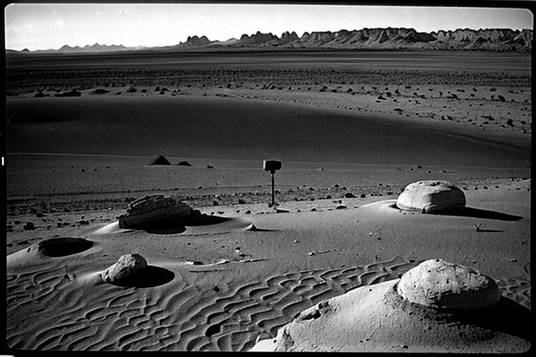
Interviews with local residents yielded vague testimonies such as "strange lights rise from that spot at night" and "I feel unwell when approaching it during certain seasons." However, reports of direct danger or incidents involving human life are few. Authorities attributed this to the area's remoteness and the inherent difficulty of activities in high-altitude environments, which naturally restricted human access.
In 2005, authorities attempted to collect detailed data by installing radio beacons and automated measurement devices. However, the installed beacons lost their position data within weeks, and internal recording devices consistently transmitted empty data. Multiple beacons exhibited similar phenomena, with no signs of physical damage. This suggests that some force might be interfering with data transmission and disabling equipment recording capabilities.
In 2018, a small drone deployed for re-investigation lost control and crashed immediately upon entering the airspace above the vegetation circle. Partial video data recovered from the crashed drone showed only dense green vegetation, with GPS signals severely disrupted. This incident suggests that the phenomenon is not merely a vegetational anomaly but is closely related to a localized distortion of physical laws.
Currently, authorities have designated this area as "Cailuma Puna Incident: Zone X" and continue remote monitoring and cross-referencing past records. The urgent task is to verify new hypotheses regarding the correlation between the vegetation circle's periodic appearance and the spatial anomalies occurring within it. The cause remains unknown.
Timeline
- 1978Satellite imagery first shows vague signs of a circular vegetation pattern in the Cailuma Puna highlands.
- October 17, 2003A Bolivian military reconnaissance helicopter discovers a distinct circular vegetation pattern, approximately 80m in diameter.
- November 5, 2003Authorities' survey team makes its first entry into the site, experiencing GPS anomalies and spatial disorientation.
- 2005Radio beacons and automated measurement devices installed for remote monitoring cease functioning within weeks.
- 2018An investigation drone loses control and crashes within the vegetation circle. Partial video data suggests spatial anomalies.
- PresentMonitoring and recording continue for "Zone X."
Witness Testimony
Bolivian Military Pilot A (2003)From above, it looked like a perfect green donut drawn on the ground. It wasn't natural. I told myself it was an illusion, but it felt eerie.
Survey Team Member B (2003)The moment I stepped inside the circle, my balance was off. GPS didn't work, and I had no idea where I was. It felt like a blindfolded child, just spinning around.
Local Rancher C (2010)Avoid that place during certain times. Livestock get lost, and once you're in, you can't even tell the direction of the sun. That grass, it traps something.
Kyu's Analysis
This case is a rare example of a compound spatial distortion and biological anomaly. The interconnected mechanism between the vegetation and the phenomenon requires elucidation.